Yorktown · plate 10
The old village above the York River
Above the siege lines sits a small town that is still lived in: one street of old brick and frame houses, a marl church, a tall white column and a beach below the bluff.
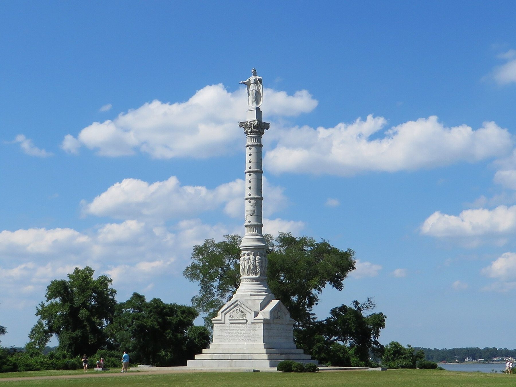
Yorktown is two places side by side. Out on the open ground south and east of town lies the battlefield of 1781. Up on the bluff above the York River is the village itself: one long Main Street of brick and frame houses, a church built of marl, a tall white column and, at the foot of the bluff, a strip of sand and a riverside path. The village is small and still lived in, and after the earthworks it repays an hour or two on foot.
A tobacco port on the bluff
The town was laid out in 1691, after the Virginia assembly ordered new port towns where ships could load tobacco and officials could collect duties on it. Fifty acres on the bluff were bought from a landowner and divided into half-acre lots. The river here is deep and fairly narrow, with Gloucester Point on the far shore, and through the first half of the eighteenth century Yorktown grew into one of the busier ports of the colony. Merchants built their houses along the top of the bluff. Warehouses, wharves and workshops crowded the waterfront below.
The trade that paid for those houses was tobacco grown by enslaved people on plantations up the York and across the Tidewater, and ships entering the river also brought enslaved Africans to be sold. Within the town, many households held enslaved men and women who worked as cooks, washerwomen, porters, carters and boatmen. Their work kept the port running, and their names survive mostly in tax lists, wills and advertisements for people who had run away.
By the Revolution the trade was already drifting elsewhere, and the bombardment of 1781 wrecked much of the town. A fire in 1814 burned more of it, and armies occupied it again in 1862. What you see now is a mix of eighteenth-century survivors, houses restored or rebuilt in the twentieth century and newer homes on old lots.
Main Street's survivors
Main Street runs along the top of the bluff, and you can walk it end to end in ten minutes without stopping. Only a few buildings stand from before the siege. The Sessions House, built in the 1690s, is usually counted the oldest house in town. The Dudley Digges House is a frame house of the middle 1700s. The Custom House, a two-storey brick building of the early eighteenth century, was probably a merchant's store and office; whether it ever served as the official customs house is less certain than its name suggests. Most of these buildings are privately owned or used by local groups, so you see them from the pavement, with occasional open days.
Grace Church stands a short walk from Main Street, toward the river. Its walls were raised around 1697 of marl, a soft stone of packed fossil shells cut from the local bluffs. The fire of 1814 gutted it, and the church was later rebuilt inside the old walls. It is still a working Episcopal parish. Thomas Nelson Jr. is buried in the churchyard, and the gravestones around him give a fair idea of the merchant families who ran the town.
The Nelson House
The largest house on Main Street is the Nelson House, a Georgian brick house built in the first half of the 1700s for Thomas Nelson, a merchant from the north of England whose trade made the family rich. His grandson, Thomas Nelson Jr., signed the Declaration of Independence, commanded the Virginia militia during the siege and was governor of Virginia in 1781. A family story holds that he urged the allied gunners to fire on his own house because British officers were using it. The story cannot be proved. The brickwork does carry scars from the bombardment, and cannonballs are set into one wall, though some may have been placed there long after 1781.
The house belongs to Colonial National Historical Park and opens at some times of year with ranger talks; check before you go. The Nelsons' fortune rested on trade and on land worked by enslaved people, and the family held large numbers of them on its plantations and in town.
A neighbouring plate · YorktownThe American Revolution Museum at YorktownThe whole war in galleries, a camp and a farmA column voted in 1781, finished in 1884
Within days of the surrender, the Continental Congress resolved to raise a marble column at Yorktown honouring the alliance with France and the victory. Nothing was built for a century. The cornerstone was laid at the centennial in 1881, and the Victory Monument was finished in 1884, at the eastern end of Main Street, on the bluff above the river.
The base carries inscriptions on the alliance, the siege and the peace treaty that followed. Above it, a ring of thirteen carved women, hand in hand, stands for the thirteen states, and a figure of Liberty tops the shaft. The Liberty you see is a replacement, put up in the 1950s after lightning damaged the first. From the lawn around the column you look straight down the river toward the Chesapeake, the water that de Grasse's fleet closed in September 1781.
Down at the water
Roads and footpaths drop from the bluff to Water Street and the shore. The beach is a narrow strip of sand on the York, used for wading, swimming and launching small boats. The water is brackish and the bottom shelves gently, but lifeguards are not something to count on. A paved riverwalk runs along the shore beside it, with a pier where visiting tall ships and other boats sometimes tie up.
Upstream, the George P. Coleman Memorial Bridge crosses to Gloucester Point. Its two spans swing open now and then to let large vessels through, a sight worth stopping for if you happen on it. In the face of the bluff near the beach is a small chamber cut into the marl, known as Cornwallis's Cave. Local tradition says the British commander sheltered there during the bombardment. Little evidence supports the tradition, but the cave is a reminder of how much of the town's life went on at the foot of the bluff.
An afternoon in a small place
The Colonial Parkway comes into Yorktown by the battlefield visitor center, and from there a path leads past earthworks to the village. Parking near the water fills on warm weekends and on event days, and a seasonal trolley has linked the waterfront, the village and the visitor center in recent years; check whether it is running. Commemorations on 19 October and Fourth of July celebrations draw the largest crowds of the year.
The village pairs naturally with the siege lines on the same day: the battlefield in the cooler morning, Main Street and the beach after lunch. In the off-season the street is quiet, the river grey and the column stark against it, which suits the place; the plate on the Triangle in winter covers that season across all three towns.