The James and Route 5 · plate 12
Driving the Colonial Parkway, Jamestown to Yorktown
Twenty-three miles of slow road join the three towns of the Triangle, running through woods and along two rivers, with no trucks, no signs for business and a surface made to look like gravel.
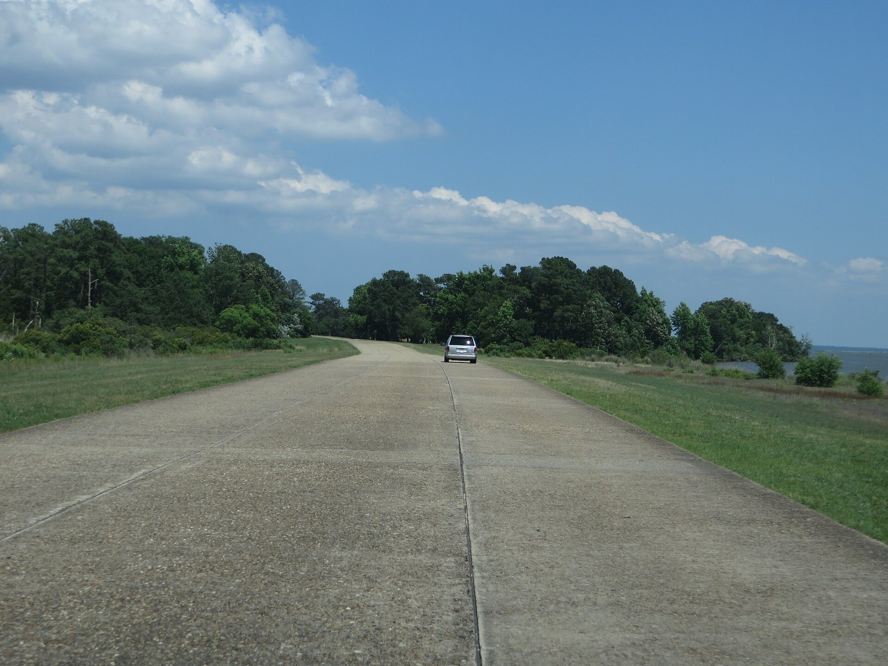
The Colonial Parkway runs for about 23 miles from Jamestown, on the James River, through Williamsburg to Yorktown, on the York. It is the thread that ties the Triangle together, and it was built for exactly that: to carry visitors between the three towns without passing a petrol station, a billboard or a lorry. The road belongs to Colonial National Historical Park and is managed by the National Park Service. Driven without stops it takes about forty minutes. Driven well, with a few pull-offs and a picnic, it can fill a slow morning.
You can join it at either end or in the middle at Williamsburg, and you can drive it in either direction. Going from Jamestown to Yorktown follows the order of history, from 1607 to 1781.
A road designed as a landscape
Colonial National Monument was created in 1930, taking in Jamestown Island and the Yorktown battlefield, and the parkway was part of the plan from the start. Park Service engineers and landscape architects drew it as a pleasure road in the manner of the parkways then being built around American cities and in the national parks: gentle curves, wide grassy margins, views opened and framed through the trees, and nothing built along it to sell anything.
Work began at the Yorktown end in the early 1930s, and the stretch from Yorktown to Williamsburg came first. The section beneath Williamsburg followed. The last leg, from Williamsburg to Jamestown, was finished in 1957, in time for the 350th anniversary of the landing. The parkway took nearly three decades to build, through the Depression and a world war, and you can still see small differences in style between its sections.
The rules follow from the design. Commercial vehicles are not allowed. The speed limit is low and enforced, the road has no shoulders, and there is no lighting at night. Deer cross at dawn and dusk. Treat it as a road to drive slowly, not a short cut.
The pebbled surface and the brick bridges
The first thing most drivers notice is the colour of the road. Instead of black asphalt, the parkway is paved in concrete laid in panels, with the surface brushed and washed while it set to expose a layer of river gravel. The result is a warm brown, pebbled road that blends with the woods and fields. It is also rough and noisy under tyres, with a bump at every joint, and patched in many places where the old concrete has cracked.
The bridges and overpasses carry the same idea. They are concrete structures faced in red brick, many with arches, built to suggest the brickwork of colonial Virginia. None of them copies any real colonial structure, and colonial Virginia had no roads remotely like this one. The whole road is a twentieth-century picture of the past, and an unusually careful one.
The whole road is a twentieth-century picture of the past, and an unusually careful one.
The York shore
From Yorktown the parkway heads west along the south bank of the York River. Several pull-offs give long views across the water, which is more than a mile wide here and busy at times with naval vessels and work boats. Much of the land on the inland side belongs to the Navy, and you will pass fences and gates along this stretch. There are picnic areas along the York section, and creeks such as Indian Field Creek and Felgates Creek open marsh views on the inland side of the road.
The York was the heart of another country before it was an English river. Upstream, on the far shore in what is now Gloucester County, lay Werowocomoco, the principal town of Wahunsenacah, the paramount chief the English called Powhatan, where John Smith was brought as a captive in the winter of 1607. Archaeologists confirmed the site early this century; it is not visible from the parkway and is not generally open. Farther up, where the Pamunkey and Mattaponi rivers meet to form the York, the reservations of the Pamunkey and Mattaponi peoples remain on their ancestral land.
A neighbouring plate · WilliamsburgDuke of Gloucester Street, end to endFrom the Capitol to the College of William & MaryUnder Williamsburg
Midway along, the parkway turns south across the peninsula and passes beneath the restored town in a tunnel, so that the road would not cut through the historic area above. The tunnel was begun in the early 1940s and, after delays caused by the war, opened later in the decade. It is short, but low and dim after the bright woods, so slow down and switch on your lights. Tall vehicles should check the posted clearance before entering. Exits on either side lead to the Colonial Williamsburg visitor center and into town; from there you can park and walk to Duke of Gloucester Street.
The James shore
South of Williamsburg the road reaches the James and follows the shore for several miles, the most open part of the drive. The river here is wide and flat, with the low wooded shore of Surry County on the far side. At College Creek and other pull-offs there are narrow sandy beaches, used for picnics and wading. Swimming is at your own risk, and the shore is eroding in places. During storms and very high tides, water can lap onto the road along this stretch.
The land behind the shore was patented in the decades after 1607 and worked into tobacco fields, first by English indentured servants and then, increasingly through the later 1600s, by enslaved Africans. Little of that is marked from the road. The parkway's planners were interested in views and in the story of English settlement, and the people who cleared and farmed these fields under compulsion did not figure in their plans. Today the park says more about them, mostly at Jamestown and Yorktown rather than along the road. The last miles run through woods and marsh to a bridge over Powhatan Creek and end at the entrance to Jamestown Island, with Jamestown Settlement and the state ferry landing close by.
Cycling it, and other cautions
Many cyclists ride the parkway, and it is a lovely road on a bicycle, but not an easy one. The surface is bumpy and the joints jar, there is no shoulder, and drivers are looking at the river rather than the road. Early mornings at weekends, when traffic is light, are the best time. Wear bright clothing and use lights. If you would rather have a separate path, the Virginia Capital Trail starts near the Jamestown end and runs west to Richmond, away from cars.
There are no services along the road, so carry water and set off with fuel. Restrooms are at the visitor centers at each end and at a few picnic areas. Speed checks are frequent, and a parkway ticket is a federal matter rather than a local one. Spring brings dogwood and fresh green; autumn brings colour in the hardwoods; winter thins the trees and opens the widest river views. Road works and closures happen, especially after storms, so check the park's current conditions before you set off, and if you are heading on to Yorktown, the plate on walking the siege lines picks up where the road ends.